Get the latest tech news
German roads thrown into chaos after Google Maps mislabels highways as closed
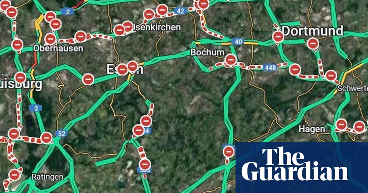
German motorists likely felt disheartened at the sight of all the stop signs on Google Maps on Thursday. The Guardian reports that major roads in western, northern,...
The Guardian reports that major roads in western, northern, south-western and central parts of the country were shown as closed. With Google Maps drawing information from third parties, the issue could partly have been related to the German Automobile Club's warning that there may be heavy traffic at the start of the holiday. Germany was cursing the service again earlier this month when it showed highway tunnels being closed in part of the country when they were open.
Or read this on r/technology